University of Cambridge
2020-2021
Brief Description
While working on the William Gates Building (WGB) smart building test-bed, I have experimented with a range of data visualisation to display sensor and BIM data.
This page contains two talks on the creation of smart building visualisations and broader sensor deployment.
Link to a longer pre-print paper.
Systems Research Group (Cambridge CST) talk - January 21st, 2021.
ACM SenSys BuildSys 2021 | Demo Presentation - November 18th, 2021.
Contents


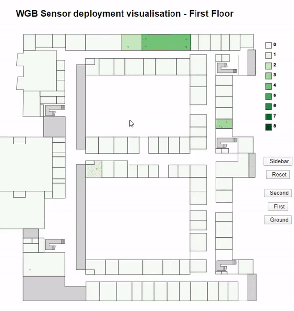
The video materials show the WGB recreated solely from the information we acquired from the official floorplans that can be accessed by all Computer Lab researchers.
This page further shows two visualisation demos for the WGB. One was written in D3.js, the other in Three.js.
These are incomplete examples and do not show the full scope of the project, e.g. including all of the APIs, data collection and integration architectures that were created during this initial deployment. Please refer to the published and pre-print papers for more information.
D3.js visualisation for floorplans and sensors
While developing front-end data visualisations for the Adaptive City Platform we experimented with a range of tools to display the incoming sensor data from dozens of deployed sensors.
For the most part these experiments were done using the D3.js library.
Real-time sensor heatmaps
Instead of relying on the click-on-the-sensor-and-inspect-the-data paradigm, our approach was to construct individual room-bound heatmaps for the WGB.
The metaphor driving the data visualisation was to depict new data points emerging in real-time on the heatmap, updated continuously as if mimicking raindrops, with the data being delivered through a WebSocket connection.
The video below showcases multiple raindrop ripples (or splashes) appearing on a heatmap generated over a lecture theatre floorplan:
8x8 IR sensor integration
Some of the deployed sensors came with an 8x8 IR camera, allowing us to see real-time snapshots of what these sensors were seeing.
More examples
On-demand latest sensor readings (pre-alpha) - discontinued.
Room selection from a list (pre-alpha) - discontinued.

Experimental Three.js visualisation
A demo of how a 3D interactive body can be generated from simple 2D floorplan data (pre-alpha) - discontinued.

These experiments culminated in the creation of the Adaptive City Platform, links can be found at the top of the page or by clicking on /research.